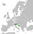
ფაილი:Republic of Venice 1789.svg

ორიგინალი ფაილი (SVG ფაილი, ნომინალურო 450 × 456 პიქსელი, ფაილიშ ზჷმა: 927 კბ)
თე ფაილი რე Wikimedia Commons-შე დო შილებე გჷმორნაფილქ იჸუას შხვა პროექტეფს. თეშ ეჭარუა ფაილიშ ეჭარუაშ ხასჷლა თუდო რე მოჩამილი.
რეზიუმე
ლიცენზირაფა
- თქვა დუდიშულო შეილებჷნა:
- ნახანდიშ გობჟინაფა – ნახანდიშ კოპირაფა, გობჟინაფა დო გჷნოჩამა.
- დორსხილეფიშ აკოქიმინუა – ნახანდიშ გიშათინუა
- გეჸვენჯი პიჯალეფით:
- ავტორიშ მეწურაფა – თქვა წყუშ აკმაქიმინალი მეუწურუათ ოკო თი შარათ, მუჭოთ დარინუ ავტორქ ვარდა საავტორო ნებეფიშ მაღვენჯიქ. მარა ვართ თეშ, ითამ წყუშ ავტორქ ალობა მერჩეს თქვა ვარდა ალობა მეჩჷ თქვანიშით აკოქიმინელჷ ნოწარმუს.
- კჷნ მანგი პიჯალეფით გობჟინაფა – დო თქვა ქოთირანთ, ვარ-და გჷთმაჭყანთ ახალ ნახანდის თე ნახანდიშ გჷმორინაფათ-და, თქვა გიღჷნა ნება თინა გაბჟინუათ კჷნ თი ვარ-და ომანგე ლიცენზიათ, ნამუშჷთ იბჟინუაფჷ წყუ.
ატვირთვის ჟურნალი
This image is a derivative work of the following images:
- File:Europe_1789.svg licensed with Cc-by-sa-3.0
- 2013-04-14T03:44:26Z Alphathon 450x456 (858577 Bytes) Corrected some errors in northern Italy
- 2013-04-14T01:38:01Z Alphathon 450x456 (853881 Bytes) tweaked again
- 2013-04-14T01:36:10Z Alphathon 450x456 (853881 Bytes) Tweaked Holy Roman Empire border style
- 2013-04-14T01:33:26Z Alphathon 450x456 (853857 Bytes) == {{int:filedesc}} == {{Information |Description={{en|A blank Map of Europe circa 1789. This map also includes a border for the [[:en:Holy Roman Empire|Holy Roman Empire]]. Since there are so many small German states, they h
Uploaded with derivativeFX
მუკნაჭარეფი
ელემეტეფი, ნამუეფთ ეხანტილი რე ათე ფაილს
გჷმოხანტილი ობიექტი
საავტორო უფლების სტატუსი ქართული
copyrighted ინგლისური
ლიცენზია ქართული
14 პირელი 2013
media type ინგლისური
image/svg+xml
ფაილიშ ისტორია
ქიგუნჭირით რიცხვის/ბორჯის თიშო, ნამჷ-და ქოძირათ ფაილი თი რედაქციათ, ნამუ რედაქციას თი რიცხვის/ბორჯის რდუნ.
| რიცხუ/ბორჯი | ჭკუდი | გონზჷმილაფეფი | მახვარებუ | კომენტარი | |
|---|---|---|---|---|---|
| მიმალი | 02:20, 27 გერგობათუთა 2021 |  | 450 × 456 (927 კბ) | Cplakidas | Fixing Venetian Albania, adding Cythera to Venice |
| 11:55, 17 გჷმათუთა 2021 |  | 450 × 456 (803 კბ) | Fenn-O-maniC | Fixed the Russo-Swedish border to match the Treaty of Åbo of 1743 | |
| 13:23, 27 ფურთუთა 2020 |  | 450 × 456 (821 კბ) | Facquis | Clear map | |
| 21:16, 18 პირელი 2013 |  | 450 × 456 (820 კბ) | Alphathon | Various fixes | |
| 07:54, 14 პირელი 2013 |  | 450 × 456 (802 კბ) | Alphathon | == {{int:filedesc}} == {{Information |Description={{en|A map of the Republic of Venice circa 1789.}}{{de|Eine Landkarte die Republik Venedig c. 1989.}} |Source={{Derived from|Europe_1789.svg|display=5... |
ფაილიშ გჷმორინაფა
გეჸვენჯი ხასჷლა გჷმირინუანს თე ფაილს:
ფაილიშ გლობალური გჷმორინაფა
თე ფაილი გჷმირინუაფუ გეჸვენჯი ვიკეფს:
- azb.wikipedia.org-ს გჷმორინაფა
- bg.wikipedia.org-ს გჷმორინაფა
- ca.wikipedia.org-ს გჷმორინაფა
- ckb.wikipedia.org-ს გჷმორინაფა
- cs.wikipedia.org-ს გჷმორინაფა
- de.wikipedia.org-ს გჷმორინაფა
- el.wikipedia.org-ს გჷმორინაფა
- en.wikipedia.org-ს გჷმორინაფა
- eu.wikipedia.org-ს გჷმორინაფა
- fa.wikipedia.org-ს გჷმორინაფა
- fy.wikipedia.org-ს გჷმორინაფა
- he.wikipedia.org-ს გჷმორინაფა
- hi.wikipedia.org-ს გჷმორინაფა
- hr.wikipedia.org-ს გჷმორინაფა
- it.wikipedia.org-ს გჷმორინაფა
- ko.wikipedia.org-ს გჷმორინაფა
- lfn.wikipedia.org-ს გჷმორინაფა
- lij.wikipedia.org-ს გჷმორინაფა
- lmo.wikipedia.org-ს გჷმორინაფა
- mk.wikipedia.org-ს გჷმორინაფა
- ml.wikipedia.org-ს გჷმორინაფა
- ms.wikipedia.org-ს გჷმორინაფა
- pl.wikipedia.org-ს გჷმორინაფა
- pt.wikipedia.org-ს გჷმორინაფა
- rue.wikipedia.org-ს გჷმორინაფა
- ru.wikipedia.org-ს გჷმორინაფა
- sk.wikipedia.org-ს გჷმორინაფა
- szl.wikipedia.org-ს გჷმორინაფა
- tr.wikipedia.org-ს გჷმორინაფა
- uk.wikipedia.org-ს გჷმორინაფა
- zh.wikipedia.org-ს გჷმორინაფა
მეტამუნაჩემეფი
თე ფაილს ოხოლჷ გეძინელი ინფორმაცია, ნამუთ ოეგებიეთ თი ცირფულ კამერაშე ვარ-და სკანერშე რე გეძინელჷ, ნამუთ რდჷ გჷმორინაფილი თე ფაილიშ გაჭყაფალო ვარ-და დაცირფაფალო. ფაილიშ ორიგინალი თირელი ქორენ-და, შილებე კანკალე დეტალი ვა გჷშაძირუანდას ფაილშა მიშაღალირჷ თირუეფს.
| კუნტა დუდჯოხო | A blank map of Europe ca. 1789 |
|---|---|
| სურათიშ ჯოხოდვალა | A blank map of Europe, circa 1789. This map is licensed under the Creative Commons Attribution-Share Alike 3.0 Unported license (https://creativecommons.org/licenses/by-sa/3.0/) by the wikimedia user "Alphathon" (http://commons.wikimedia.org/wiki/User:Alphathon), and is based upon "Blank map of Europe.svg" (http://commons.wikimedia.org/wiki/File:Blank_map_of_Europe.svg), the details of which follow:
A blank Map of Europe. Every country has an id which is its ISO-3166-1-ALPHA2 code in lower case. Members of the EU have a class="eu", countries in europe (which I found turkey to be but russia not) have a class="europe". Certain countries are further subdivided the United Kingdom has gb-gbn for Great Britain and gb-nir for Northern Ireland. Russia is divided into ru-kgd for the Kaliningrad Oblast and ru-main for the Main body of Russia. There is the additional grouping #xb for the "British Islands" (the UK with its Crown Dependencies - Jersey, Guernsey and the Isle of Man) Contributors. Original Image: (http://commons.wikimedia.org/wiki/Image:Europe_countries.svg) Júlio Reis (http://commons.wikimedia.org/wiki/User:Tintazul). Recolouring and tagging with country codes: Marian "maix" Sigler (http://commons.wikimedia.org/wiki/User:Maix) Improved geographical features: http://commons.wikimedia.org/wiki/User:W!B: Updated to reflect dissolution of Serbia & Montenegro: http://commons.wikimedia.org/wiki/User:Zirland Updated to include British Crown Dependencies as seperate entities and regroup them as "British Islands", with some simplifications to the XML and CSS: James Hardy (http://commons.wikimedia.org/wiki/User:MrWeeble) Validated (http://commons.wikimedia.org/wiki/User:CarolSpears) Changed the country code of Serbia to RS per http://en.wikipedia.org/wiki/Serbian_country_codes and the file http://www.iso.org/iso/iso3166_en_code_lists.txt (http://commons.wikimedia.org/wiki/User:TimothyBourke) Uploaded on behalf of User:Checkit, direct complaints to him plox: 'Moved countries out of the "outlines" group, removed "outlines" style class, remove separate style information for Russia' (http://commons.wikimedia.org/wiki/User:Collard) Updated various coastlines and boarders and added various islands not previously shown (details follow). Added Kosovo and Northern Cyprus as disputed territories. Moved major lakes to their own object and added more. List of updated boarders/coastlines: British Isles (+ added Isle of Wight, Skye, various smaller islands), the Netherlands, Germany, Czech Republic, Denmark, Sweden, Finland, Poland, Kaliningrad Oblast of the Russian Federation (and minor tweaks to Lithuania), Ukraine, Moldova (minor), Romania, Bulgaria, Turkey, Greece, F.Y.R. Macedonia, Serbia, Bosnia and Herzegovina, Montenegro, Albania, Croatia, Italy (mainland and Sicily), Malta (http://commons.wikimedia.org/wiki/User:Alphathon). Added Bornholm (http://commons.wikimedia.org/wiki/User:Heb) Released under CreativeCommons Attribution ShareAlike (http://creativecommons.org/licenses/by-sa/2.5/). |
| სიგანა | 450 |
| სიმაღალა | 456 |


